Blogs
Discover the Natural Wonders of Vietnam
Vietnam is a geographically diverse country in Southeast Asia, packed into a long and narrow strip of land.
Unique geography
Shareing land borders with China, Laos, Cambodia, stretching over 1,650 kilometers from north to south. The country features a narrow width, shrinking to just 50 kilometers at its narrowest point in the central region.
The Hoang Lien Son mountain range dominates the far northwest, containing Fansipan, the highest peak in Indochina at 3,143 meters. Further south, the Truong Son range stretches along the country, gradually giving way to narrow coastal plains and the lush Mekong Delta.
Diverse climate zones
Northern Vietnam experiences four distinct seasons, including cool winters when snow can occasionally appear on the highest peaks of Sapa or Ha Giang. Meanwhile, The central and southern regions experience a tropical monsoon climate with high humidity throughout the year.
This contrast creates a unique rhythm across the country, where one region may be enjoying chilly mountain air while another remains tropical and green.
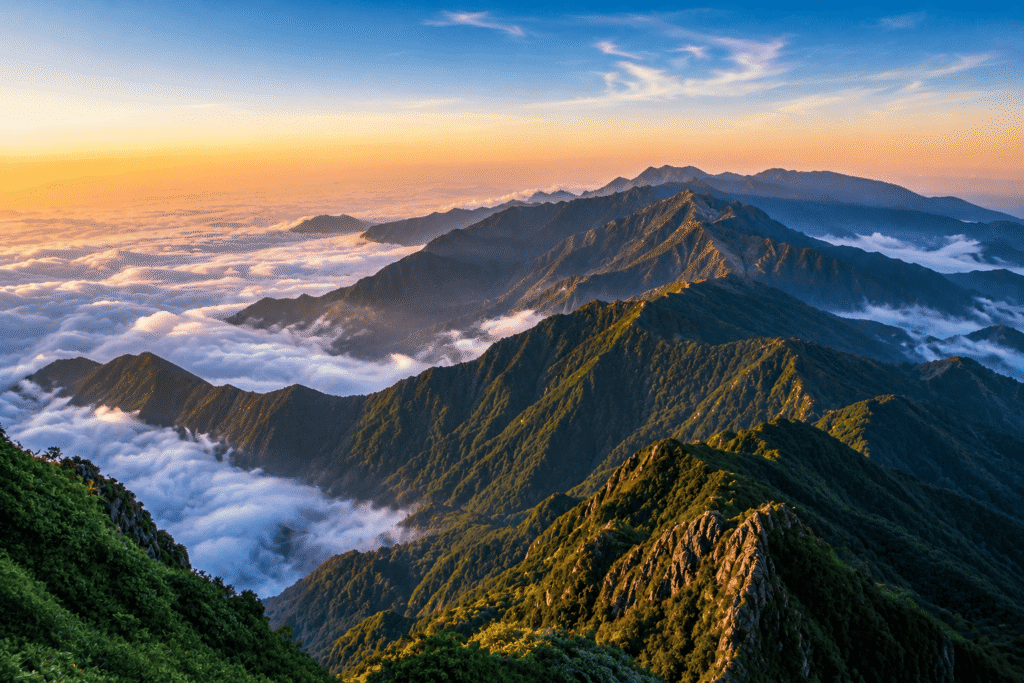
The dramatic peaks of the Hoang Lien Son mountain range
Exceptional landscapes
Karst formations & Terraces
- Dong Van Karst Plateau (Ha Giang): A UNESCO Global Geopark consisting of vast limestone fortresses shaped by millions of years of tectonic uplift. This region features vertical grey cliffs, deep canyons like the Ma Pi Leng pass, deep valleys where soil is scarce, forcing vegetation to grow directly out of rock crevices.
- Mu Cang Chai Terraced Fields (Yen Bai): Sculpted by the Hmong people over centuries, these steep mountain slopes are transformed into endless stepped rice paddies. Water from the peaks feeds these terraces, changing colors from bright emerald green during the growing season to brilliant gold during the autumn harvest.
- Ban Gioc Waterfall (Cao Bang): The largest waterfall in the country, situated right on the border with China.
The coastal & Sea karst networks
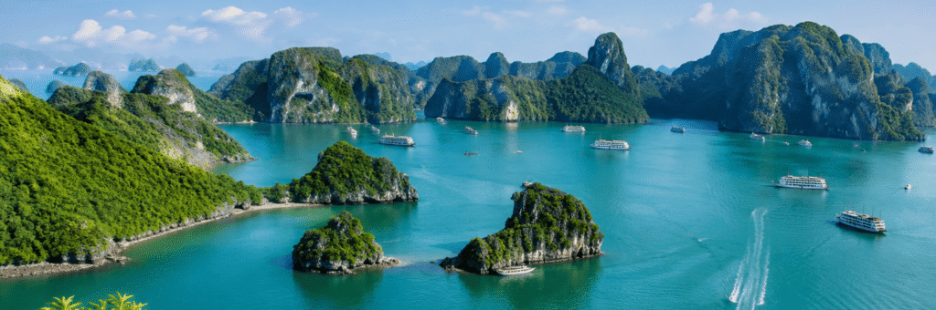
- Ha Long Bay and Lan Ha Bay: The northern limestone mountains drop directly into the Gulf of Tonkin, creating thousands of green-topped islands rising from the emerald water.
- The Sand Dunes (Binh Thuan): A striking micro-climate in the south-central coast featuring massive, shifting sand dunes known as the White and Red Sand Dunes.
The cave systems
Phong Nha (Ke Bang National Park) is home to some of the oldest karst mountains in Asia and one of the world’s most extraordinary cave systems, including Son Doong, the largest cave on Earth. Nearby caves like Hang En and Pygmy Cave are known for their enormous underground spaces, jungle-like environments, and unique cave camping experiences.
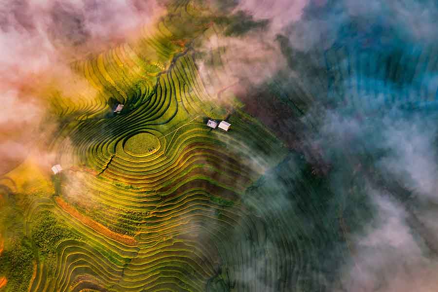
Terraced rice fields in the mountainous Mu Cang Chai District, Yen Bai Province, northern Vietnam.
(Photo: Vietnam National Authority of Tourism)
Biodiversity ecosystems
- Cuc Phuong National Park: The oldest nature reserve in Vietnam, featuring a dense millennial rainforest packed with ancient trees, prehistoric caves, over 2,000 species of flora.
- Cat Tien National Park: A crucial lowland tropical rainforest biosphere in the south, preserving ancient trees, wetlands, housing a diverse population of wild gibbons, hornbills, Asian elephants.
- Rare Terrestrial Species: These rich environments support rare, endemic wildlife species found nowhere else, including the Saola (the Asian Unicorn), the Tonkin snub-nosed monkey, the Delacour’s langur, the Indochinese tiger.
- Marine Preservation Areas: The marine ecosystems are equally rich, containing coral reefs in Nha Trang or the Con Dao archipelago. These protected waters house thousands of species of fish, sea turtles, dugongs, marine mammals.
Whether you are applying for the first time, dealing with an urgent situation, or unsure which visa type suits your trip. Our team is available 24/7 to assist with any visa-related query, from standard applications to emergency processing.
- Phone/WhatsApp: (+84) 856 598 868
- Email: info@simplevietnamvisa.com